
Historical Mapping
We are fortunate these days that the internet has brought with it many benefits. One of those is the ability to view historical maps.
Know Your Place has published many of these in an interactive format. Check out their website at http://www.kypwest.org.uk/about-the-project/
The following link will directly show the Maisemore area
Link to Maisemore at Know Your Place
Use the slidey bar (at the website - it doesn't work here!) to compare historical and current maps - and note the type of map on each side can be varied in the menu. Pan by dragging.
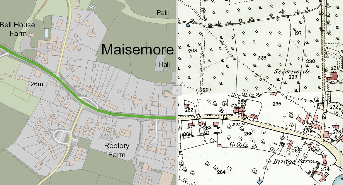
Another excellent site is, surprisingly, the National Library of Scotland - maps.nls.uk/ - which has a lot of English maps as well - and crucially at detailed 1 mile to 25" scale.
Click HERE for the direct link to Maisemore and select your map.
Maps can be zoomed right in and downloaded. They are not watermarked and can be used for non-profit websites so long as attribution is given. We've used this in THE MILESTONES PROJECT for example.
Click HERE for the direct link to Maisemore and select your map.
Maps can be zoomed right in and downloaded. They are not watermarked and can be used for non-profit websites so long as attribution is given. We've used this in THE MILESTONES PROJECT for example.
The "original" site for historical maps - www.old-maps.co.uk/ - is still there and useful at times, especially for more recent maps which the NLS doesn't have.
Click HERE for the direct link to Maisemore in 1885.
However the free service doesn't allow zooming in much and the maps are watermarked, and even if you subscribe (at a cost of £119.88pa) to get enhanced zoom you're not allowed to use them at websites.
Click HERE for the direct link to Maisemore in 1885.
However the free service doesn't allow zooming in much and the maps are watermarked, and even if you subscribe (at a cost of £119.88pa) to get enhanced zoom you're not allowed to use them at websites.
Another resource - which links to other providers such as the NLS - is Old Maps Online. We haven't used this site much but it does have links to more historical maps than the Ordnance ones at the sites above.
